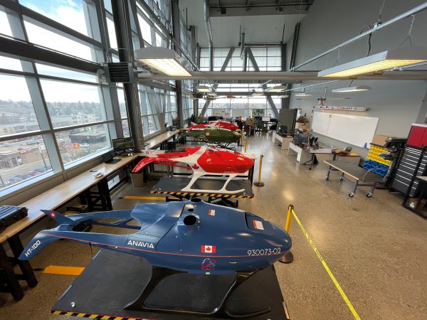
The Environmental Resiliency and Sustainability Hub (ERSH) addresses critical climate change challenges through applied research in environmental resilience and emergency response. It offers access to diverse terrains and ecosystems, creating opportunities for field research and testing for its regional partners. Centre for Innovation and Research in Unmanned Systems (CIRUS) researchers have experience in using Remotely Piloted Aircraft Systems (RPAS) for a wide range of applications, including predictive wildfire mapping, water quality assessments, medical delivery to remote communities, and the integration of advanced sensors for remote data collection, enabling ERSH to focus on wildfire mitigation, drought/flood monitoring, and reforestation/afforestation programs to enhance resilience strategies.
By fostering collaboration among interdisciplinary researchers, professionals, and policymakers, and amplifying Indigenous knowledge systems, the hub ensures culturally relevant, community-driven solutions and practical innovations. Access to state-of-the-art facilities and equipment provides researchers with the infrastructure needed to conduct in-depth experiments, simulations, and field missions in controlled and diverse environments. ERSH offers hands-on training and workshops, while promoting sustainable practices to enhance disaster prevention and mitigate the impacts of climate change.
ERSH will leverage high-performance computing, cybersecurity, and digital twin technology for environmental simulations and data analysis. Augmented and virtual reality capabilities will enable immersive, interactive experiences for partners to optimize response plans. Advanced RPAS with integrated sensors, including LiDAR and ground-penetrating radar, will provide targeted data for precise modeling. ERSH is a collaborative space supporting researchers, partners, and Indigenous and remote communities, aiming to advance disaster preparedness and environmental resiliency, locally and internationally.
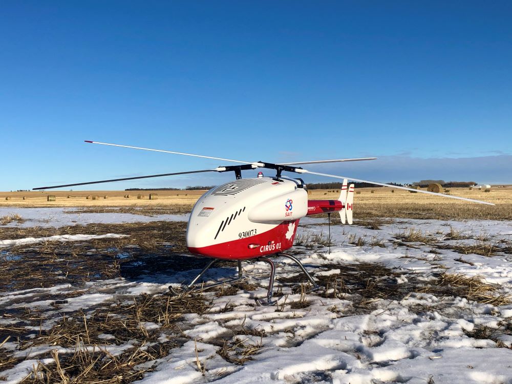
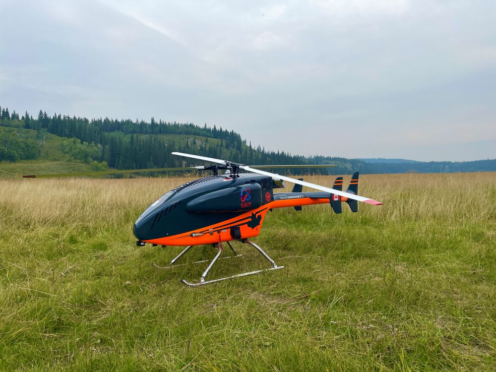
SwissDrone SDO50 V2.5 Heavy-lift RPAS with intermeshing rotors. Allows for advanced payload capabilities and beyond visual line of sight (BVLOS) flights. Has a turboshaft engine which utilizes jet fuel for flight times over three hours.
ERSH collaboration process
- Project planning:
We collaborate with internal and external partners to define project requirements such as project scope, timeline, objectives, equipment needs and assembling the appropriate team. - RPAS/sensor customization:
We customize RPAS and sensors to meet project-specific requirements, leveraging other parts of the ARIS Hub to 3D print parts, modify RPAS platforms and calibrate equipment for optimal performance. - Data collection/field work:
The CIRUS team, comprised of advanced drone pilots and visual observers will collect data for ERSH. - Data analysis:
Data collected from the field is analyzed in-house via various environmental and chemical analyses. data is securely imported into high-performance computing systems for intensive processing and analysis. - Predictive analysis and simulation creation:
Virtual replicas of physical environments are created for in depth analysis and modeling. Cybersecurity protocols ensure data integrity and secure handling. Processed data is used for predictive modelling and simulations, enabling forecasting and behavior modeling. Scenario-based simulations are run to explore various outcomes, enhancing understanding of potential impacts and solutions. - Data engagement:
Partners and collaborators engage with the data for learning, analysis and mentorship opportunities. Augmented Reality (AR) and Virtual reality (VR) systems provide immersive training environments where participants can interact with digital twins, practice response strategies (for example, wildfire management), and enhance situational awareness. - Research sharing and continuous adaptation:
Feedback from partners and collaborators is integrated to refine processes, technologies and workflows. The pipeline evolves with each project, fostering continuous improvement and adaptability.
ERSH facilities
- RPAS customization and testing lab: Space for assembling and calibrating RPAS, including testing stations for sensor integration and payload optimization.
- Data analytics area: Includes high-performance computing systems capable of securely importing and processing real-time and post-mission data, including drone imagery and geospatial data.
- AR/VR training and simulation suite: An immersive training room with VR headsets, AR glasses, motion sensors, interactive projection screens and open space for movement. Workstations to control and design training simulations, allowing responders to collaborate in virtual environments by simulating emergency scenarios such as wildfire response, flood management, and search and rescue operations.
- Education and engagement zone: Space for presentations, workshops and public engagement. An area dedicated to interactive exhibits featuring displays of ERSH technologies and project outcomes, and most importantly, a space to promote public awareness of disaster resilience and the role of technology in emergency management.
Our sensors enable a wide range of project capabilities, with each one chosen for its unique strengths to deliver precise and effective solutions.
| Sensor types | Project capabilities |
|---|---|
|
|
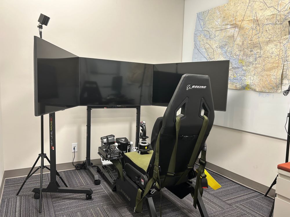
Access specialized drone training
Join the drone centre as a partner in flight and gain the skills necessary for effective RPAS operations, drone pilot training, maintenance and mission planning.
Our expertise
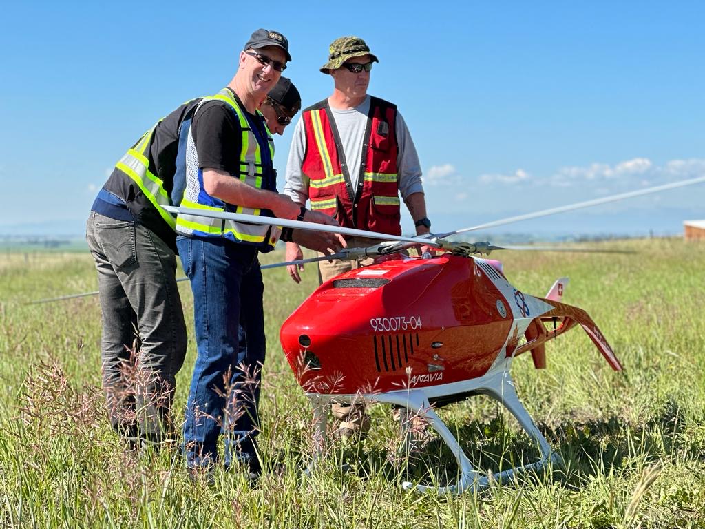
Our team brings together a diverse range of expertise and certifications to deliver cutting-edge solutions. We have Transport Canada-certified advanced RPAS pilots, with flight reviewer ratings and ROC-A radio licenses. Our team is skilled in collecting and processing data from LiDAR, multispectral, photogrammetry, thermal, visual, sonar, and GPR sensors.
Our geomatics technologist brings extensive experience in land surveying and remote sensing, while our research and disaster management specialist ensures technical innovations are translated into impactful solutions for disaster resilience and response.
With additional strengths in integrating digital technologies, ensuring data integrity and cybersecurity, and developing advanced data analytics techniques, we offer robust support for complex projects.
Contact
Applied Research and Innovation Services
Wade Hawkins, Research Chair, CIRUS
-
Email - Wade.hawkins@sait.ca
Research Services

Oki, Âba wathtech, Danit'ada, Tawnshi, Hello.
SAIT is located on the traditional territories of the Niitsitapi (Blackfoot) and the people of Treaty 7 which includes the Siksika, the Piikani, the Kainai, the Tsuut’ina and the Îyârhe Nakoda of Bearspaw, Chiniki and Goodstoney.
We are situated in an area the Blackfoot tribes traditionally called Moh’kinsstis, where the Bow River meets the Elbow River. We now call it the city of Calgary, which is also home to the Métis Nation of Alberta.
