Centre for Innovation and Research
in Unmanned Systems
Pioneering applied Remotely Piloted Aircraft Systems (RPAS) research, innovation, and learning.
At the Centre for Innovation and Research in Unmanned Systems (CIRUS), our mission is to expand the role that remotely piloted systems play in data acquisition, management, analytics, and dissemination, while creating organizational efficiencies across various sectors and regulatory environments. We aim to address key industry challenges, including the innovative application of remotely piloted systems and sensors, as well as the customization, validation, analysis, and integration of data products derived from these systems.
Through cutting-edge applied research, we take a collaborative approach to tackling these challenges, improving technology, and developing and testing new products and their applications.
While our research is primarily focused on the sky, we also explore a variety of terrestrial and submersible remotely piloted systems and sensors. As a leading research center for Remotely Piloted Aircraft Systems (RPAS) and a key supplier of highly qualified personnel to the industry, CIRUS provides students with the opportunity to work on cutting-edge technology directly related to the rapidly expanding RPAS industry both locally and worldwide.
In addition to applied research, we also focus on the following initiatives:

Canada’s first remotely-piloted aviation training centre
In April 2023, SAIT announced the launch of Canada’s first remotely-piloted aviation training centre, which will specifically focus on training, certification, research and development for heavy-lift and beyond-visual-line-of-sight Remotely-Piloted Aircraft Systems (RPAS).
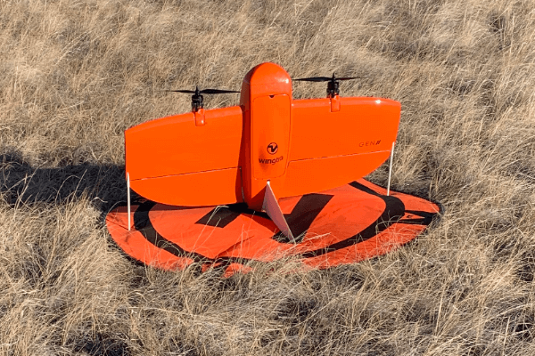
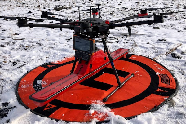
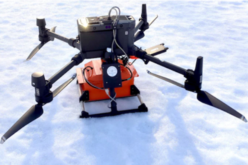
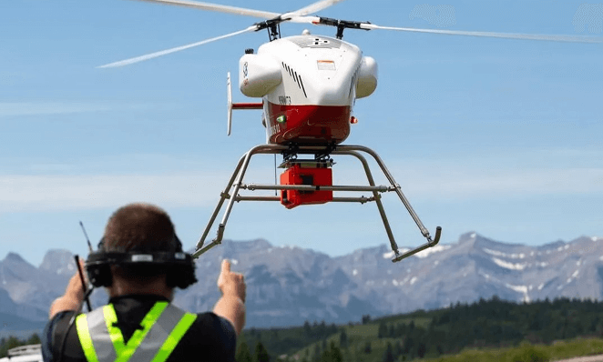
Our remotely piloted systems
CIRUS has been fortunate to receive generous funding from the Canada Foundation for Innovation (CFI), Natural Sciences and Engineering Research Council of Canada (NSERC), and Prairies Canada to support the development of our research centre and supporting applied research projects. Our research centre features a diverse and advanced fleet of remotely piloted aircraft, sensors, survey equipment, data processing and modeling software, and hardware. Some of our remotely piloted systems are the only ones in North America, making CIRUS a leading research centre on the continent.

Here's what we can offer you
At CIRUS, we use our wide range of skills and experience to develop solutions for client-specific challenges both within Canada and internationally.
Customization
No two clients have exactly the same problem to be solved, and each job requires a unique approach.
Whether it's a custom mounting system - such as the one we developed for NASA's OPLS methane detector - or developing optimal workflows for use in an active mine environment, CIRUS tailors solutions to address specific industry challenges.
Validation and integration of data
As a new technology, remotely piloted systems currently lack well-defined standards and protocols. Because of this, we are setting our own rigorous standards. Data collection starts with matching the best product to the problem - giving clients information which can be readily incorporated into their workflow.
Our service includes validating data quality, and providing information our clients can rely on.
Remotely piloted systems, sensors and related equipment
Common uses of RPAS - such as surveying and mapping - are often the starting point for longer-term industry collaborations when partnering companies see the potential for unmanned systems to impact their bottom line.
Advanced sensors, including hyperspectral imagers, allow us to monitor the health of vegetation, while ground-penetrating radar is used in subsurface mapping and geological applications.
We're developing unique applications of RPAS for methane detection to carry out surveys of oil and gas installations, such as along pipelines.
Leverage our infrastructure, advanced pilots and facility to test your idea, saving you time and money.
A lot of what we do at CIRUS is cutting edge and research-focused, and we take what we learn and share it with instructors in the program. For example, the procedures to detect wildlife or lost persons using a drone-mounted thermal sensor.

Wade Hawkins
CIRUS Research ChairProjects
At CIRUS, we're helping to expand the role unmanned systems play in data acquisition and management and create organizational efficiencies across various sectors and regulatory environments.
Working with our partners, we're addressing challenges, create efficiencies, and developing and testing new products and applications across a variety of industries.
CIRUS + Imperial
SAIT partnered with Imperial to help implement unmanned systems at Imperial's Kearl site in northern Alberta.
Watch the video to see how this collaboration leads the way in how unmanned systems can be used regularly to collect photography and supporting data to inform Imperial's Geoscience team on the site's geology while improving safety, sustainability, and operational efficiencies.
Delivering medical supplies to remote communities
Researchers at the University of Calgary, the Southern Alberta Institute of Technology (SAIT), Alberta Health Services (AHS) and Alberta Precision Laboratories (APL) are partnering with the Stoney Nakoda Nations (SNN) to deliver medical equipment and test kits for COVID-19 to remote areas, and to connect these communities to laboratories more quickly using these remotely piloted aircraft.
Precision Cattle Ranching
With the use of UAV technology, thermal and RGB cameras, an RFID reader and LIDAR unit, cattle ranchers will be able to track their cattle from a remote location automatically. By identifying animals and reading their tags quickly, the data transferred is instantaneous and reduces time spent manually tracking individual animals.
Do you have a project in mind?
Whether you're starting with an idea or an early design concept, we want to learn more. Our commitment is to provide exceptional value to our partners, staying mindful of budget constraints while actively pursuing funding opportunities on your behalf. Let's talk ideas and numbers.
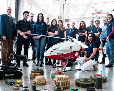
Our research team
The expertise available through CIRUS is diverse, with all researchers and faculty contributing their unique skills and experiences. SAIT also engages several of Alberta's leading colleges, allowing us to draw on an even greater pool of expertise when needed.
A hub of innovation
The ARIS research and innovation hub brings together researchers, innovators, industry and students to develop skills and collaborate. Join the network now.
Contact us
Applied Research and Innovation Services
-
Phone - 403.284.7056
-
Email - applied.research@sait.ca

Oki, Âba wathtech, Danit'ada, Tawnshi, Hello.
SAIT is located on the traditional territories of the Niitsitapi (Blackfoot) and the people of Treaty 7 which includes the Siksika, the Piikani, the Kainai, the Tsuut’ina and the Îyârhe Nakoda of Bearspaw, Chiniki and Goodstoney.
We are situated in an area the Blackfoot tribes traditionally called Moh’kinsstis, where the Bow River meets the Elbow River. We now call it the city of Calgary, which is also home to the Métis Nation of Alberta.